
Short presentation#
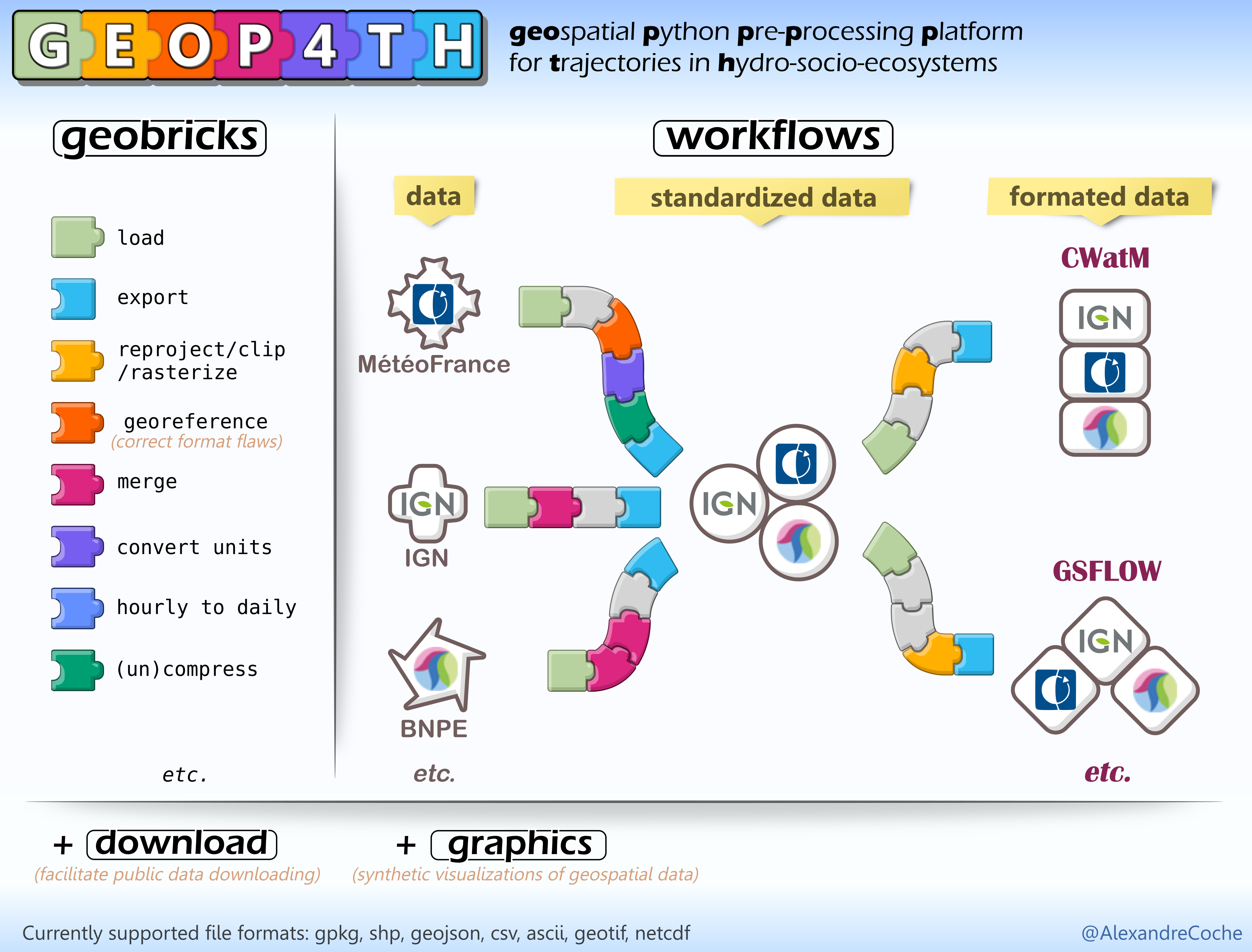
GEOP4TH (pronounced /ʤiɒpɑːθ/ jee-uh-pa-th, for GEOspatial Python Pre-Processing Platform for Trajectories in Hydro-socio-ecosystems) is a collection of python tools to facilitate the processing of geospatial data. It provides:
- Simple, ergonomic and generic functions to manipulate space-time data
based on generic functions with the right dose of abstraction so that users do not have to worry about the specificities of the data formats
strongly simplifies the handling of space-time data (like netCDF)
especially useful for hydrological models preprocessing
- A framework to collaboratively develop and share complete pre-processing workflows designed for specific datasets or applications
the generic functions can be easily combined into workflows
once a workflow has been developped for a particular dataset or application, it can be shared within the corresponding GEOP4TH modules
these workflows can then be run in one function call
so far, routines for some common French datasets (SIM, EXPLORE2, BNPE, OSO…) and for CWatM preprocessing have been implemented
this part is fundamentally collaborative and any contribution is more than welcome!
Today there are a vast amount of hydroclimatic or geographic datasets publicly available, as well as a wide choice of applications (models, softwares, web apps…) using such types of data. Nevertheless, interfacing these data with their applications is far from straightworward and can sometimes require a lot of time and skills beyond those of the application field (Knoben et al., 2022). The toolbox GEOP4TH aims to facilitate this interface between data and applications.
Many tools are available nowadays to process geospatial data. GEOP4TH takes advantage of existing tools to combine a genuine python interface, simplicity of use, modular functions and collaborative sharing in the same free software.
For more details, have a look at How does GEOP4TH compare to existing tools?